Three Greek research projects that use artificial intelligence to address critical challenges and support the 17 United Nations Sustainable Development Goals (SDGs) have received significant international recognition. The projects “FLOGA” and “Triton” of the National Technical University of Athens and “Pioneers for AI” of the non-profit organization Science For You (SciFY) were included in the IRCAI Global Top 100, the international initiative of the International Research Centre on Artificial Intelligence (IRCAI), under the auspices of UNESCO.
Since 2022, two teams of specialized researchers at the Remote Sensing Laboratory of the NTUA’s School of Surveying and Geoinformatics Engineering have started working and analyzing data for the most detailed and accurate mapping of areas affected by natural disasters. As explained to the Athens-Macedonian News Agency by Yannis Papoutsis, assistant professor of NTUA and associate researcher at the National Observatory of Athens, Yannis Papoutsis, the “FLOGA” and “Triton” projects, through artificial intelligence and data resulting from satellite imagery, are attempting to move towards accurate mapping that can then be used by the Civil Protection, the Fire Brigade and other stakeholders.
As Mr. Papoutsis, the “FLOGA” team, led by PhD candidate Mara Straka and in collaboration with the Fire Service, has developed an artificial intelligence system designed to automate the detection and mapping of areas affected by fires. “Utilizing high-resolution multi-spectral satellite data, our model produces highly accurate delineations of burned areas, providing critical data for immediate response and relief efforts, restoration planning, and climate research on the impacts of fires on the ecosystem,” Mr. Papoutsis.
More specifically, NTUA researchers have proceeded to create a dataset of satellite imagery from the “SENTIMENT-2” satellite, having simultaneously mapped the burnt areas in great detail. “The interesting thing is that these mappings have been done by the Fire Service, by the Geoinformatics Department. By taking data from satellites and through photo interpretation – that is, they analyze the image and manually fill in the contours of the fire – they make an outline tailored to the needs of the Fire Department for decision making. At the same time, they have provided us with the scientific data so that we can proceed with the corresponding data creation through satellite imagery as well as the mapping that the Fire Department has done. On the basis of these we are developing AI models so that we can go from satellite data to automatic mapping of burnt areas completely automatically and with very high accuracy. This project has progressed and is now in the process of being delivered to the Ministry of Digital Government as part of the National Micro-Satellite Programme. This gives the Ministry the opportunity to cooperate with any entity that needs to have this information, “notes Mr Papoutsis and adds that the second part of the project relates to the automated reception of the above data so that an agency can use them to identify a fire and at the same time have the ability to activate the process of mapping a burned area during the fire and after it is completed. “All of this needs automation and a small information system to support it with high availability, meaning the system doesn’t go down. This is an integrated system and in June it is being handed over to the Ministry of Digital Government. Possibly it can even be used for this fire season as well,” Papoutsis stressed to APE-MPE.
![]()
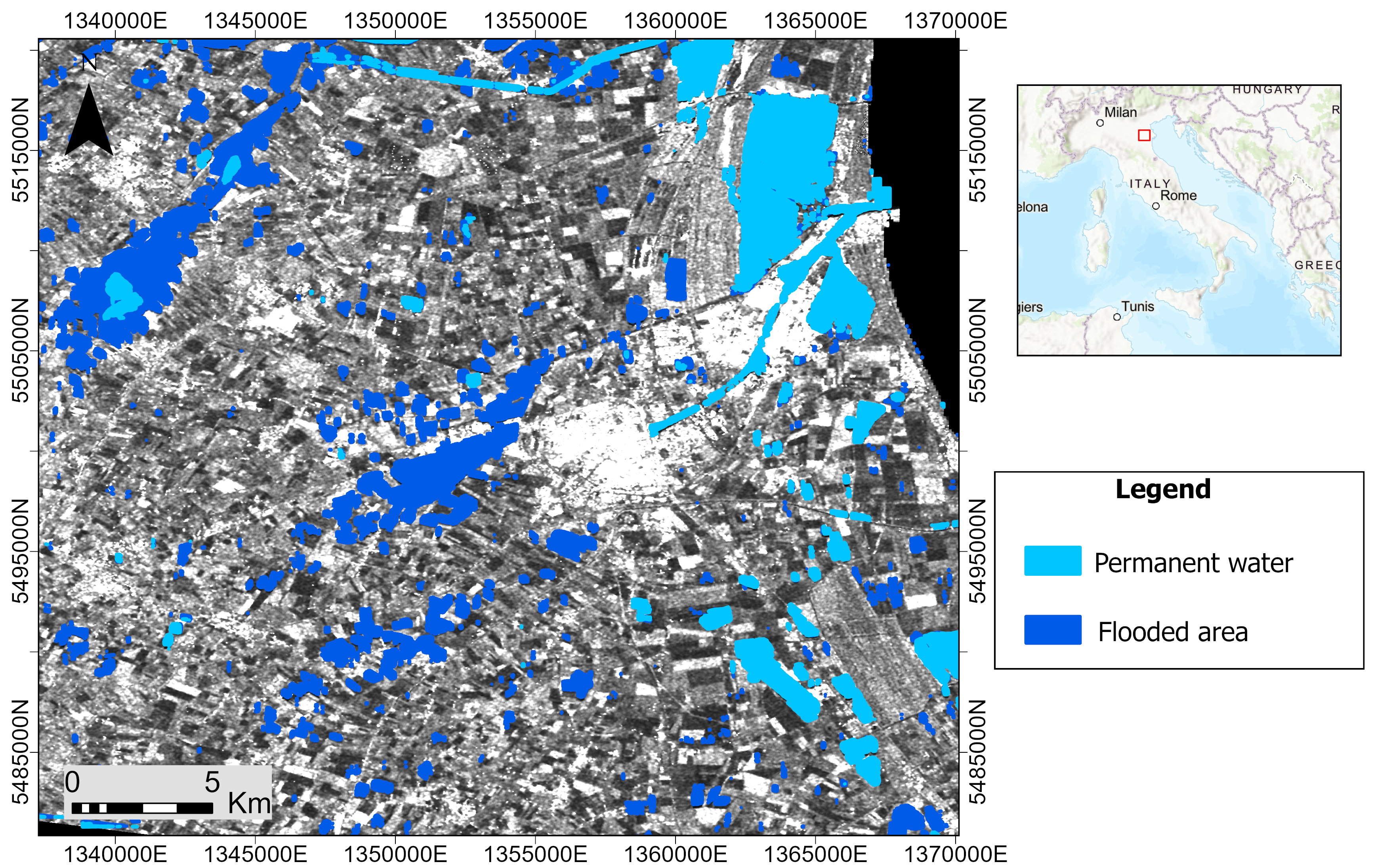
As for the “Triton” project, as Mr. With regard to the Triton programme, as Papoutsis explains, this relates to flood mapping. Triton, led by Nikolaos Ioannis Boundos and Mara Straka, uses SAR satellite radar data and artificial intelligence technology to provide fast and accurate flood mapping on demand, anywhere in the world. A key innovation of “Triton”, according to Papoutsis, is that it can “penetrate through the clouds”. “It takes a lot of expertise to manage this data – and that’s something we’re doing and we started around 2022, where a team of 3-4 researchers found flood events around the world, and based on those events we downloaded the data. Then we did the photo interpretation to find exactly the contours of the flood and based on that we built the corresponding models. It is a program for automatic mapping of floods with very high accuracy, which was not done before. It used to be necessary for an experienced photo-interpreter of satellite data to come in and correct a mapping, now that doesn’t have to be done. It can be done very quickly and directly,” he notes, adding that both projects are funded by the European Space Agency and the European Commission.
![]()
The “Pioneers for AI” initiative of the non-profit organization Science For You – SciFY received the award for the second consecutive time and was recognized for actively contributing to three Sustainable Development Goals: quality education (SDG 4), decent work and economic development (SDG 8) and reducing inequalities (SDG 10).
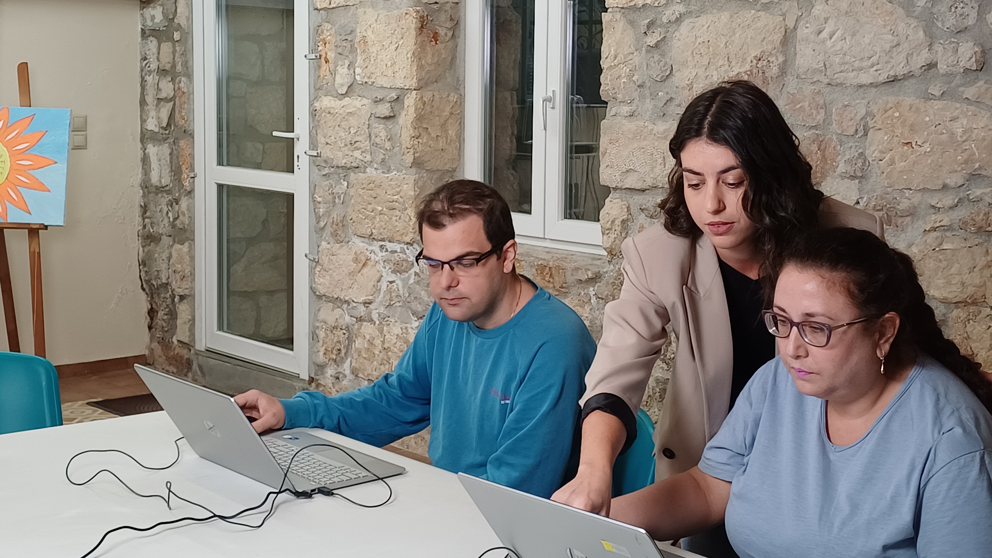
“A key factor in the selection was the expansion of the program through the Disabled AI Pioneers project, a pioneering action that trains people with disabilities to work in the AI field. As part of the project, 35 people with autism, psychiatric disorders and motor disabilities attended a specially tailored training programme, 26 trained people with disabilities worked preparing data for training AI models, 6 research teams from the NCSR “Demokritos” and the Research Centre “ATHENA” were supported by the work of disabled people, 19 professionals from disability support organisations were trained in AI to integrate and guide the beneficiaries throughout the project”, Science For You – SciFY notes.